
Mauritius
Republic of Mauritius
Local name: Mauritius, Moris
Zoomed ×4.5
- Capital
- Port Louis
- Population
- 1.2 million
- 156th in the world (2025)
- Area
- 2,040 km²
- 169th in the world
- Density
- 610 people/km²
- 10th in the world
In brief
Mauritius is a country in East Africa. Its capital is Port Louis. With 1.2 million inhabitants in 2025, it ranks 156th in the world by population, out of the 195 countries recognised by the UN. Its area is 2,040 km². An island nation, Mauritius has no land border.
GDP per capita stands at $12,991 (2025), 76th in the world. Life expectancy at birth is 73.8 years (2024). 39% of the population lives in cities.
History of Mauritius
Uninhabited until the 16th century, the island was colonised by the Dutch in 1638, who named it after Maurice of Nassau; the dodo died out there in the late 17th century. French in the 18th century as Isle de France, it became British in 1810. After slavery was abolished in 1835, hundreds of thousands of indentured workers came from India: their descendants now form the majority of the population. Independent on 12 March 1968, Mauritius has been a republic since 1992 and is one of Africa’s strongest democracies.
Geography of Mauritius
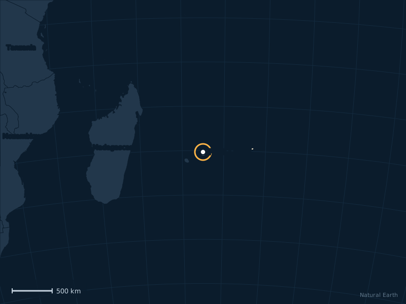
A volcanic island in the Indian Ocean east of Madagascar, Mauritius is almost entirely ringed by a coral reef. The country also includes Rodrigues and Agaléga, and claims the Chagos archipelago, which the United Kingdom agreed in 2025 to hand back.
Map of Mauritius
Flag of Mauritius
The flag of Mauritius is red, blue, green and yellow. Its official proportions are 2:3 (height to width).
- Red25%
- Blue25%
- Yellow25%
- Green25%
Share of the flag’s surface taken by each colour.
What the flag stands for
Four horizontal bands, red, blue, yellow and green: red for the struggle for independence, blue for the Indian Ocean, yellow for the light of independence, green for the vegetation.
Sources: Wikipedia, articles “Mauritius” and “Flag of Mauritius”.
Download the flag (SVG) All 2 red, blue, green and yellow flags All the flags of the world
Fact file
| Official name | Republic of Mauritius |
|---|---|
| Capital | Port Louis |
| Official languages | English, French, Morisyen |
| Currency | Mauritian rupee (MUR, ₨) |
| Demonym | Mauritian |
| Continent | Africa, East Africa |
| Access to the sea | Yes, island nation |
| Area | 2,040 km² |
| Calling code | +230 |
| Internet domain | .mu |
| UN status | Member state |
Economy and society
GDP per capita
$12,991
76th in the world (2025)
Life expectancy
73.8 years
at birth (2024)
Urban population
39%
Sources: World Bank (2025) for population and economy, Natural Earth for the map, mledoze/countries and Wikidata for reference data. Method.