Malawi
Republic of Malawi
Local name: Malaŵi
Zoomed ×3.6
- Capital
- Lilongwe
- Population
- 22.2 million
- 60th in the world (2025)
- Area
- 118,484 km²
- 98th in the world
- Density
- 188 people/km²
- 53rd in the world
In brief
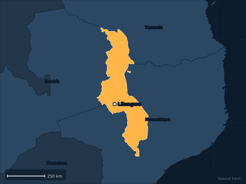
Malawi is a country in East Africa. Its capital is Lilongwe. With 22.2 million inhabitants in 2025, it ranks 60th in the world by population, out of the 195 countries recognised by the UN. Its area is 118,484 km². Landlocked, it shares land borders with Mozambique, Tanzania and Zambia.
GDP per capita stands at $672 (2025), 186th in the world. Life expectancy at birth is 67.6 years (2024). 18% of the population lives in cities.
History of Malawi
The Maravi kingdom dominated the Lake Malawi region from the 16th century. The explorer David Livingstone arrived in 1859, and the territory became the British protectorate of Nyasaland in 1891. Independent on 6 July 1964, Malawi was led by Hastings Kamuzu Banda, president for life, until the first multi-party elections in 1994.
Geography of Malawi
Landlocked Malawi stretches along Lake Malawi, Africa’s third-largest lake, set in the Great Rift Valley. Mount Mulanje (3,002 m), in the south, is the highest point.
Map of Malawi
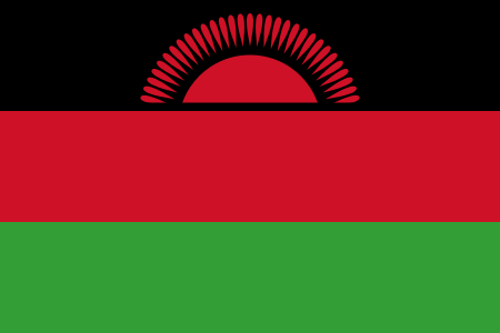
Flag of Malawi
The flag of Malawi is red, green and black. Its official proportions are 2:3 (height to width).
- Red38%
- Green34%
- Black28%
Share of the flag’s surface taken by each colour.
What the flag stands for
Black, red and green, with a red rising sun on the black band. Black represents the people, red the blood of the martyrs, green nature; the sun stands for the dawn of hope and freedom for Africa.
Sources: Wikipedia, articles “Malawi” and “Flag of Malawi”.
See also: flags with a sun.
Download the flag (SVG) All 2 red, green and black flags All the flags of the world
Fact file
| Official name | Republic of Malawi |
|---|---|
| Capital | Lilongwe |
| Official languages | English, Nyanja |
| Currency | Malawian kwacha (MWK, MK) |
| Demonym | Malawian |
| Continent | Africa, East Africa |
| Access to the sea | No, landlocked |
| Area | 118,484 km² |
| Calling code | +265 |
| Internet domain | .mw |
| UN status | Member state |
Economy and society
GDP per capita
$672
186th in the world (2025)
Life expectancy
67.6 years
at birth (2024)
Urban population
18%
Sources: World Bank (2025) for population and economy, Natural Earth for the map, mledoze/countries and Wikidata for reference data. Method.